
Information Hub
C-ITS
Cooperative Intelligent Transport Systems (C-ITS) are an innovative way to improve road transportation by integrating advanced technologies. The main goal of C-ITS is to enable communication between vehicles and infrastructure, resulting in safer, more efficient, and environmentally friendly transportation solutions. C-ITS utilises connectivity and data exchange between vehicles (V2V), between vehicles and infrastructure (V2I), and even between vehicles and pedestrians (V2P). Through wireless communication protocols, vehicles can share critical information such as speed, location, and upcoming road conditions in real-time. Similarly, infrastructure elements like traffic signals and road signs can transmit data to vehicles, aiding in navigation and decision-making. C-ITS has present and future use cases in collision avoidance, traffic management, emergency services, and environmentally conscious driving. The main difference between Intelligent Transport Systems (ITS) and C-ITS is that ITS focuses on optimizing transportation systems through the intelligent use of technology. However, unlike C-ITS, it may not necessarily prioritize direct communication between vehicles and infrastructure or vehicles themselves.
Figure: Asfinag
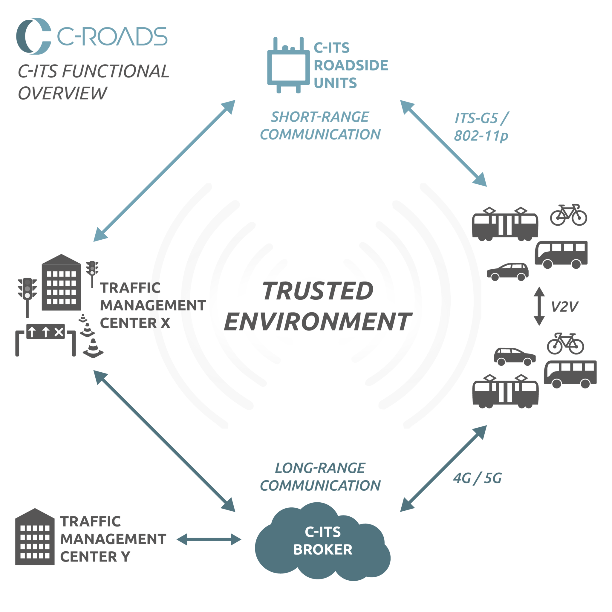

Harmonisation is the core asset of the C-Roads Platform, since it ensures sustainable and efficient deployment. Consequently, all partners share the vision of the main objectives, which are – beside harmonisation – (pilot) implementation, demonstrations of C-ITS deployment and advance to large-scale deployment.
The C-Roads Platform is a cooperation of Member States and road operators working on the deployment of harmonised and interoperable C-ITS services in Europe.
The C-Roads Platform approach pursues cooperation on a holistic level in order to cover all dimensions linked with the deployment of C-ITS, such as sharing experiences and knowledge regarding deployment and implementation issues, as well as user acceptance. It also follows a bottom-up approach involving national deployments. These form basic elements for pan-European C-ITS implementation. The national deployments moved on to cross-site testing, which allowed them to grow together and achieve transnational interoperability. In this way C-Roads ensures European cohesion of C-ITS deployment in the European Union with regards to a long-term roll-out.
DATEX II is the electronic language used in Europe for exchanging traffic information and data. Nowadays, it is a set of standards that support the digitalisation and automation of the entire road transport ecosystem. This contributes to safe, green, and efficient travel of people and goods. DATEX II allows for standardized data provision for all types of vehicles, from bicycles to heavy lorries, and enables the digital expression of road transport infrastructure dynamics and incidents in a standardized manner. DATEX II distributes traffic and travel information, as well as traffic management information, in a language and presentation format-independent manner. This eliminates the possibility of misunderstandings or translation errors by the recipient.

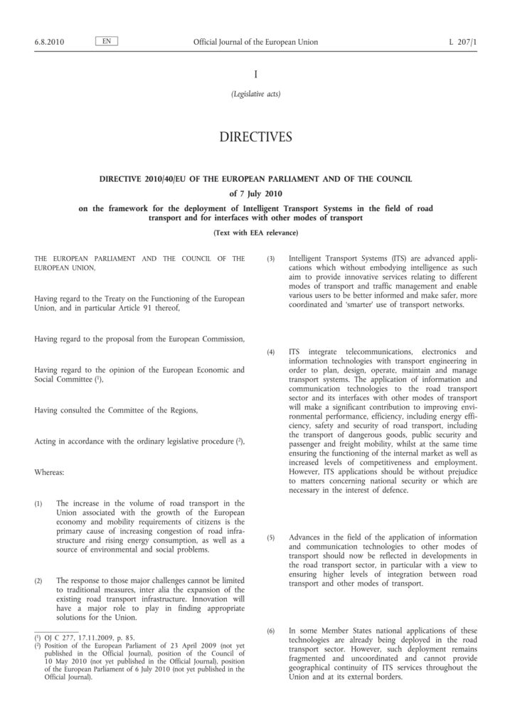
Directive 2010/40/EU, also known as the ITS Directive, aims to promote the use and compatibility of Intelligent Transport Systems (ITS) across EU member states. It sets out objectives and guidelines to encourage the development and integration of ITS technologies, defining their scope across various transport modes, including road, rail, maritime, and air transport. The directive prioritises areas such as traffic management, road safety, sustainable mobility, and multimodal travel information services for ITS deployment. It establishes frameworks for interoperability, standardisation, and harmonisation of ITS systems and services. Member states must draft national ITS action plans outlining strategies to promote ITS deployment and meet directive objectives. The directive promotes EU-level coordination to facilitate collaboration among member states, industry stakeholders, and other relevant entities in the ITS domain. It encourages the deployment of ITS infrastructure, including intelligent transport systems, cooperative systems, and traffic data exchange, to enhance transport efficiency, safety, and environmental sustainability. The use of ITS is encouraged for public transport, which includes real-time passenger information systems, electronic ticketing, and multimodal journey planning. ITS can also enhance the efficiency and sustainability of freight transport by optimizing logistics, reducing congestion, and improving safety.
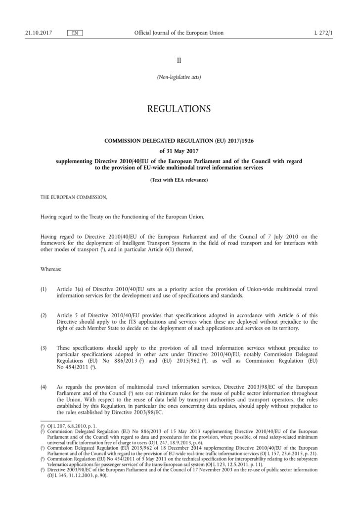
The EU Delegated Regulation 2017/1926 supplements Directive 2010/40/EU by establishing specifications to ensure accurate and widely available EU-wide multimodal travel information services for ITS users. It sets out regulations for exchanging and sharing travel-related information among various service providers and stakeholders. It establishes criteria for the accuracy, timeliness, and accessibility of travel information across various transportation modes. The regulation aims to make travel information services accessible to all users, including those with disabilities or special needs. It facilitates seamless travel experiences for users across different modes of transportation and geographical regions by promoting interoperability between different information systems and platforms. The Delegated Regulation 2017/1926 aims to facilitate the development and provision of EU-wide multimodal travel information services. This will contribute to the creation of a more integrated and user-friendly transportation system across the European Union.
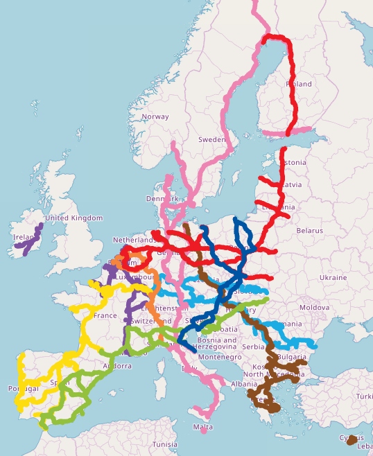
The EU’s trans-European transport network policy, the TEN-T policy, is a key instrument for the development of coherent, efficient, multimodal, and high-quality transport infrastructure across the EU. It comprises railways, inland waterways, short sea shipping routes and roads linking urban nodes, maritime and inland ports, airports and terminals.
It fosters the efficient transportation of people and goods, ensures access to jobs and services, and enables trade and economic growth. It strengthens the EU’s economic, social and territorial cohesion and creates seamless transport systems across borders, without physical gaps, bottlenecks or missing links. It also aims to reduce the environmental impact of transport and to increase the safety and the resilience of the network.
Source: EC Europe
National Access Points (NAPs) are central platforms for mobility data. They facilitate access, easy exchange and reuse of transport related data in Europe, in order to help support the provision of EU-wide interoperable travel and traffic services to end users.
It has become apparent, that the existing NAPs are quite different in their setup and data access interfaces. Also, the data formats and standards used differ throughout Europe. To work on a better alignment the National Access Point Coordination Organisation for Europe (NAPCORE) project was started.
NAPCORE is co-financed by a Programme Support Action under the European Commission’s Connecting Europe Facility. NAPCORE has been launched as coordination mechanism to improve interoperability of the National Access Points as backbone of European mobility data exchange. NAPCORE improves the interoperability of mobility data in Europe with mobility data standard harmonisation and alignment. Also, NAPCORE increases access and expands availability to mobility related data by coordinated data access and better harmonisation of the European NAPs. Furthermore, NAPCORE empowers National Access Points and National Bodies by defining and implementing common procedures and strategy, strengthening the position and the role of NAPs, supporting steps towards the creation of European-wide solutions to better facilitate the use of EU-wide data.


The MERIDIAN project will foster digitalisation of the mobility system focussing mainly on the CEF Core Network Corridors Scandinavian-Mediterranean and North Sea-Baltic. This will be achieved by implementing digital systems and services along the busiest European freight corridors. The project will further target expansion of digital infrastructure, roll-out of C-ITS in central Europe, implementation of ITS for bottlenecks on open road and tunnels, digital corridor management and Multimodal Services.
MATIS (Mediterranean-Atlantic Transport Intelligent Systems): The project aims to deploy Smart Advanced ITS solutions covering three TEN-T corridors (Mediterranean, Atlantic, North-Sea Mediterranean) in four countries: France, Italy, Spain and Portugal, along 8.621 km of Core and 10.990 km of Comprehensive networks. The main benefit of the project will be the increased efficiency, interoperability and safety of the road traffic in the EU..

CROCODILE was a project that preceded X4ITS. It started in 2013 with the participation of 10 countries from Eastern and Central Europe. The initiative aimed to overcome organizational barriers and establish an infrastructure for providing information on road traffic flows throughout the entire service chain. The exchange of data and information will be facilitated using common standards, resulting in high-quality end user information services and more efficient traffic flows. The partners collaborated in an integrated manner, conducting workshops to develop coordinated approaches and solutions for implementation. The main objectives are to promote cross-border coordination, establish infrastructure for data collection, processing, and access, and provide safety-critical traffic information and information on parking space availability to truck drivers.